GPS
 |
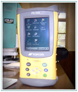 The professionals at Camp & Associates Land Surveying, P.C. utilize the latest in Global Positioning Systems (GPS) technology. Drawing GPS information from a constellation of satellites orbiting the earth, Camp & Associates provides precise locations to geodetic and state plane coordinates as required on specific projects. This relatively new technology enables Camp & Associates to pinpoint exact land locations, even to within an inch of a precise point. This technology is especially useful in Georgia Department of Transportation and other governmental surveys.
Global Positioning Systems equipment is also utilized by Camp & Associates to provide control on large and complicated projects, and to do static and real-time kinematics surveys. Their GPS technology is further used to perform:
|
|
502 South Greenwood Street LaGrange, Georgia 30240 T: (706) 884-6066 F: (706) 884-6067 [email protected] |
©2024 Camp & Associates Land Surveying, P.C. All Rights Reserved. Site by Kelsey. - Sitemap